Sydney is drowning in rain. August has been the city's wettest in 27 years, and the past six years mark the heaviest rainfall stretch since records began at Observatory Hill in 1858. Since January 2020, the city has collected more than 9,300 millimetres - topping the previous six-year record of 9,120mm from 1985-1990.
Sydney Sees Wettest Six-Year Stretch on Record
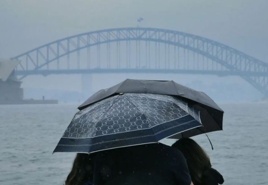
Sydney is drowning in rain. August has been the city's wettest in 27 years, and the past six years mark the heaviest rainfall stretch since records began at Observatory Hill in 1858.
Since January 2020, the city has collected more than 9,300 millimetres - topping the previous six-year record of 9,120mm from 1985-1990. With months of 2025 still to come, that record is set to climb higher.
The shift follows the 2017-19 drought. In 2020, Sydney recorded its wettest February in 30 years, ending the year with 1,552mm - well above the long-term average of 1,221mm. 2021 was also wetter than normal (1,290mm), before 2022 smashed records with 2,530mm. Rain eased slightly in 2023 during El Niño but rebounded in 2024 to 1,641mm.
This year has continued the trend: even mid-winter, rainfall has already surpassed Sydney's annual average.
Why So Wet?
Meteorologists point to changes in wind patterns. Since 2020, stronger easterly winds have brought more moisture from the Tasman Sea, while high-pressure systems over southern Australia have shifted south, cutting dry westerlies and boosting humid easterlies along the coast.
Whether this signals a permanent shift to a wetter Sydney or a multi-year anomaly remains unclear, though southern Australia's long-term rainfall trends suggest a changing climate could be at play.
August Deluge
Sydney's late winter has been soaked. By Monday, the city had already received nearly three times the usual August rainfall of 80mm. Rain has fallen on three out of four days, and another 100mm is possible by Friday, likely pushing August into the top four wettest on record.
The downpours are driven by a familiar pattern: a southern high-pressure system sending moist onshore winds, enhanced by a mass of cold polar air. The Bureau of Meteorology has issued flood watches for northern NSW, including the Mid North Coast and North West Slopes.
Next week may bring drier westerlies and a few sunny days, but the spring outlook favours continued above-average rainfall across eastern Australia. For Sydney, it seems the deluge is far from over.
More Top Stories