Outback Queensland is set to receive much-needed rain, while residents in the state's south-east endure worsening heatwave conditions before a Christmas Day cool change. A tropical low moving east across Queensland is expected to bring widespread showers and thunderstorms, with wet conditions across much of the state on Christmas Day, apart from the far south-west.
Wet Christmas Forecast For Queensland
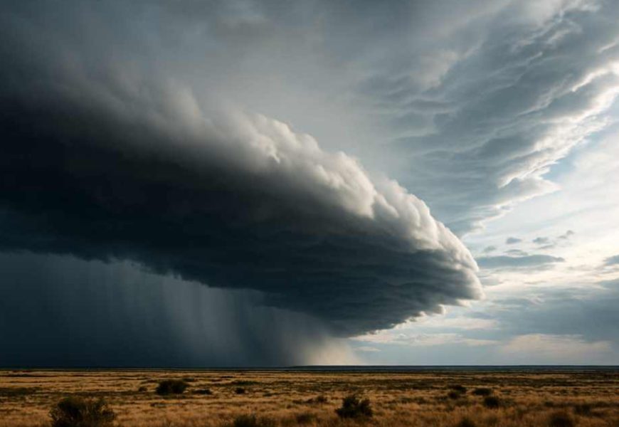
Outback Queensland is set to receive much-needed rain in the lead-up to Christmas, while residents in the state's south-east endure worsening heatwave conditions before a Christmas Day cool change.
A tropical low moving east across Queensland is expected to bring widespread showers and thunderstorms, with the Bureau of Meteorology forecasting wet conditions across much of the state on Christmas Day, apart from the far south-west.
Senior forecaster Felim Hanniffy said the system crossed into Queensland from the Northern Territory on Sunday and is already delivering significant rainfall.
"We have extensive shower and thunderstorm activity moving across the state during the early days of this week," he said.
"Initially across western Queensland, then spreading into central and eastern parts of the state as we move through the second half of the week."
North-west Queensland recorded localised rainfall totals of up to 65 millimetres on Sunday, with daily falls of 50 to 100 millimetres expected in the days leading up to Christmas.
Queensland Police Service Emergency Management coordinator in Mount Isa, Elliot Dunn, urged travellers in the north-west to plan carefully and avoid dangerous conditions.
"Be prepared to turn around and take an alternate route," he said.
"Don't drive through floodwaters. It's not worth the risk, even if some locals think they know better."
Heatwave to peak in the south-east
In contrast, south-east Queensland will face intensifying heat and humidity early in the week, with severe heatwave conditions forecast for Monday and Tuesday.
Mr Hanniffy said soaring dew points would make conditions feel more like the tropics.
"Particularly close to the coast, conditions will become increasingly humid," he said.
"The dew point ticking up into the mid-20s is similar to what you'd normally see in Far North Queensland at this time of year."
Coastal areas in the south-east are expected to reach the low 30s, while inland temperatures climb into the mid to high 30s. Parts of the western Darling Downs and eastern Maranoa and Warrego districts could hit 40 degrees on Monday.
Relief is expected from Boxing Day as a south-easterly change brings cooler conditions and helps concentrate rainfall across central and north-east Queensland.
Wet Christmas forecast
While Queensland's north tropical coast will start the week mostly dry, rain is forecast to set in by Christmas Day.
"Christmas Day, Boxing Day and into the weekend look quite wet for north-east Queensland," Mr Hanniffy said.
"For most of the state, apart from the far south-west, showers and thunderstorms are likely on Christmas Day, with the risk of localised heavy falls."
He said central and northern regions could see a wet end to the Christmas week, rounding out a seasonally active holiday period for much of Queensland.
More Top Stories