Ex-Tropical Cyclone Koji has crossed the north Queensland coast south of Ayr, unleashing intense rainfall and ongoing flood risks as it tracks inland. The former cyclone made landfall between Ayr and Bowen early Sunday, weakening into a tropical low but continuing to deliver widespread heavy rain across the region. Authorities warn the system could still produce dangerous conditions, with flash flooding the primary threat.
From Cyclone to Deluge: Koji Dumps 340mm of Rain on North Queensland
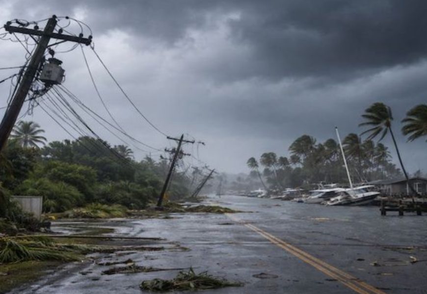
Ex-Tropical Cyclone Koji has crossed the north Queensland coast south of Ayr, unleashing intense rainfall and ongoing flood risks as it tracks inland.
The former cyclone made landfall between Ayr and Bowen early Sunday, weakening into a tropical low but continuing to deliver widespread heavy rain across the region. Authorities warn the system could still produce dangerous conditions, with flash flooding the primary threat.
The Bureau of Meteorology says some locations could record up to 340 millimetres of rain within 24 hours. While the heaviest falls on Sunday were expected along the coast between Ayr and St Lawrence, the impact zone is forecast to extend south toward Rockhampton from Monday.
A severe weather warning for heavy rainfall remains in place from south of Proserpine to Gladstone. Forecaster Sue Oates cautioned that locally intense downpours could trigger life-threatening flash flooding, particularly in vulnerable catchments.
Major flood warnings continue for several north Queensland rivers, including the Pioneer, Georgina and Flinders. Exceptional rainfall totals have already been recorded, with Clarke Range inland of Mackay receiving 362 millimetres in 24 hours, while 331 millimetres fell in just six hours at Mattie O'Neil Bridge. Cattle Creek, west of Mackay, recorded 370 millimetres in 12 hours.
Emergency services have carried out multiple rescues, including two men and five children trapped by rapidly rising creeks at Finch Hatton, west of Mackay. Authorities also renewed pleas for motorists to avoid floodwaters after a woman drove into inundated roads near Bogie with two children. All occupants were able to safely self-extract.
Strong winds and hazardous marine conditions have torn several boats from their moorings along the coast, pushing vessels ashore in parts of the Whitsundays and Bowen. Wind gusts peaked at 113 kilometres per hour on Hamilton Island before easing later on Sunday.
Power outages have affected about 22,000 homes, largely across the Mackay and Whitsundays regions, according to Ergon Energy. David Crisafulli said crews were working to restore electricity as conditions allow.
Transport disruptions continue, although the Bruce Highway has reopened at Peter's Flat north of Bowen. Motorists are being urged to drive with caution and expect delays, with additional closures near Proserpine at Hamilton Plains and Kelsey Creek. Proserpine and Mackay airports remain closed, while Townsville Airport has reopened.
Forecasters say the system remains "lopsided," with the bulk of the rainfall falling south of the centre. Angus Hines from the Bureau of Meteorology warned that six-hourly rainfall totals of up to 150 millimetres are still possible, with 100 to 200 millimetres expected across large areas of north Queensland.
Extra SES, police and ambulance resources have been deployed to the Whitsunday Islands as a precaution. Whitsundays Mayor Ry Collins said the storm's impact was being keenly felt, with rough seas and multiple vessels breaking free from moorings.
Despite some easing along the upper Pioneer Valley, Mackay Mayor Greg Williamson urged residents to remain vigilant. "We're not out of the woods yet," he said.
More Top Stories